Have you ever thought about taking a trip on the biggest highway in the world? This is PANAmericana trip, with more than 48,000 km in length, connecting different continents and visiting countless countries.
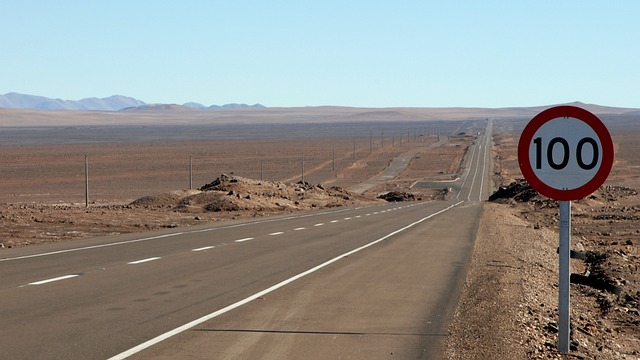
The PANAmerican route passes through different climatic regions, from extreme cold to intense heat. Geographically it passes through mountains, tropical forests and even desert.
But first, discover the paradise of options that Booking.com has to offer and turn your travel dreams into reality! Making your reservations through our link you will be helping us and you won’t pay anything extra for it 🙂
O booking.com is our trusted website, we made all our reservations through them and now you can also make purchases from airline tickets!
Taking this route is challenging for the adventurers on duty.
Read too:
- Cell phone chip for your international trip: learn tips, where to buy and how it works
- Tips on how to make your trip PERFECT
- Frequently asked questions about the USA
- travel to canada
- 5 treasures around Santiago de Chile
- Machu Piccho – Peru
Curiosities
The route was created in year 1937, the countries through which the road joined signed an agreement to connect in full.
However, each country is responsible for its own roads, which makes the route structurally different (roads good for driving or dirt roads, bad).
In the year of 2006, Kin Sanders was the adventurer who broke the world record completing the highway route in the shortest time, taking just 34 days.
So, would you have the courage to travel all these kilometers?
PANAmericana Travel Route
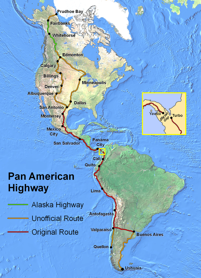
The route is an incredible route with countless countries, starting with:
- Buenos Aires to Ushuaia (Argentina);
- Valparaiso (Chile);
- Lima (Peru);
- Quito (Ecuador);
- Medellín (Colombia);
- San Salvador (El Salvador);
- Mexico City (Mexico);
- Denver (United States);
- Edmonton (Canada);
- Alaska (United States).
Analyzing the overland route, the only place that is impossible to pass is the gap between the Colombia and Panama, there are 87 kilometers of tropical forests. It is possible to travel by sea or plane.
If you are car, you can pay a container to do the transfer. in this link is the contact of a local company.
In addition to countries, you will pass through oceans Pacific, Antarctic and Atlantic.
How to go to Travel through PANAmericana
First, it all depends on how much you want to invest and how much time will have to make the journey.
You can travel a few kilometers by car, on the routes safer, with incredible landscapes and flying to the places that are most convenient for you. difficult to drive and dangerous.
After all, you need to be aware that there are dangerous places and that the best thing about traveling is living without fear, enjoying the scenery and discovering incredible places.
There are adventurers who are not afraid and go through the whole terrestrial route🇧🇷 The choice will be yours!
starting to Travel through PANAmericana
The route can start from wherever you prefer. Here I started the journey in Argentina, but I could start it in Alaska.
It's up to you!
On the way from Buenos Aires to Ushuaia, you must take a single route, known as Route 3, it will be 3 thousand kilometers.
Tip: take this route by car it will be fantastic🇧🇷 It will take you around 2 to 3 days. It will be worth it with every beautiful landscape you will find along the way.
However, if you prefer to go by plane, the flight time between Buenos Aires and Ushuaia is on average 3:30 hours.
Ushuaia (Argentina) to Quellón (Chile)
This route is beautiful. There are 2,743 kilometers if you travel by car, an average of 40 hours, or 2 to 3 days.
The only issue is that you have already covered a good part of the route going from Buenos Aires to Ushuaia, and you will need to take it back, as this is the only route (Ruta 3).
Chile
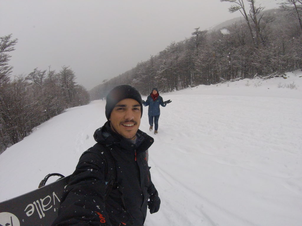
The journey through Chile is very beautiful! The adventure begins in Quellón, full of hills, sheep, sturdy boats and a charismatic population with their local crafts.
Tip: Remember that in Chile it is still cold! Have cold weather clothes in your suitcase!
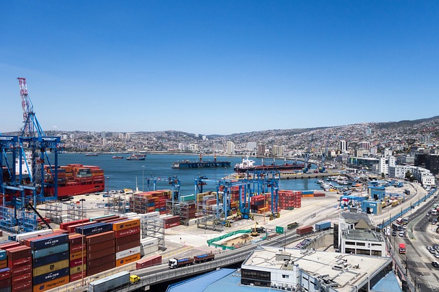
Traveling for 1,400 kilometers until reaching Valparaiso, which is a port city on the coast, famous for the colorful houses on top of cliffs.
You can visit the museum of the famous Pablo Neruda, Chilean poet-diplomatician who won the Nobel Prize for Literature.
Still in Chile, with another 1,300 kilometers, make a stop at Antofagasta, another port city.
Located in the Atacama Desert, where photos are taken in the “Mano del Desierto”, a large sculpture of a hand in the middle of the sands.
To the north of the city there is an incredible feature of a Natural Monument La Portada, it is a huge natural arch, with beautiful colors and countless animals.
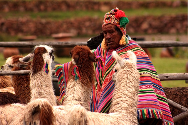
Peru
It's hard to go through such beautiful places and not stop to admire the landscape and take pictures. But, as I said earlier, it all depends on your time.
Leaving from Antofagasta to Lima in Peru, there are 2 thousand kilometers, covered in 2 to 3 days.
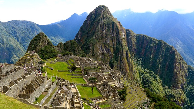
Lima has my heart. It is a city with historic buildings, being able to explore the Huaca Pucllana archaeological site (Pre-Inca ruins), the Parque de La Reserva which is full of fountains with lighting and water dancing (too beautiful), Pachacámac Ruins and much more history.
Ecuador and Colombria
One more stop after 1,800 kilometers, taking 2 to 3 days. Quito is one of those cities that everyone loves, with beautiful landscapes, good culture and a lot of history.
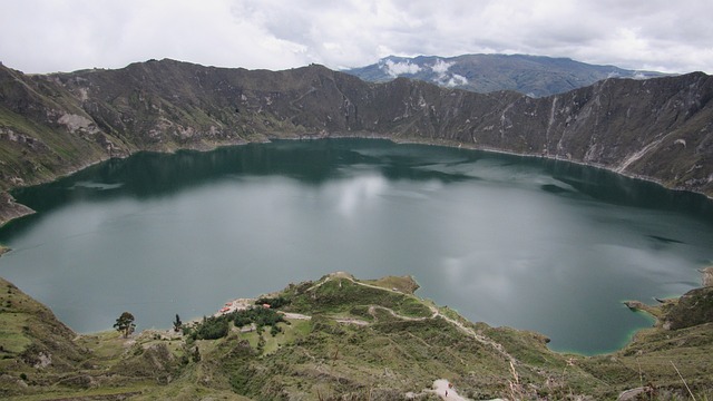
You can meet the Quilotoa volcano, register the route in the “city in the middle of the world” than ground zero, visit the historic churches and discover the many local artisan shops.
Passing through Cali, which already belongs to Colombia, and transferring between Panama.
Remembering that it all depends on how you are doing the route, car or plane. This route is where there is no possibility to pass by car.
Another observation I make is that this route is a little delicate referring to security. So be careful when going through this route.
As I said earlier, taking a plane and landing in Panama or directly in El Salvador or Mexico City is a great option.
Mexico
Moving straight to Mexico City, known for its Templo Mayor which is a 13th century Aztec temple. Baroque Metropolitan Cathedral, from the Spanish pioneers and a lot of history sheltered by the murals of Diego Rivera.
They are located in the historic center Zocalos. There are numerous museums, palace of arts and beautiful landscapes.
following for almost thousand kilometers, going through Monterrey, the landscapes are already different, very different from the beginning of the route. This city is overpopulated and with an incredible postcard in the middle of the city, Cerro de La Silla, 1820 meters high and an incredible view.
United States of America
Once you pass the Mexico route, which is amazing. The landscape keeps changing! Now being in the United States.
Tip: don't forget your US visa! If not, your trip will come to an end in Mexico.
In the United States there is no defined route where the PANamericana route passes. On the map there are two most frequented routes:
- Dallas, Minneapolis to Edmonton (Canada)
- Albuquerque, Denver, Billings, Calgary (Canada) to Edmonton (Canada).
In other words, the choice is yours. On the one hand, you will pass through Oklahoma, Kansas, Lowa until you reach Edmonton in Canada. Traveling its 3,600 kilometers, around 4 days.
On the other hand, starting with Albuquerque, Denver, Billings, Calgary (Canada) to Edmonton (Canada). It will be 2,800 kilometers, a difference of almost 1,000 kilometers.
In terms of discovering landscapes, I suggest taking this last route, because here you will pass through more national parks, discover incredible desert and mountain landscapes.
Canada
Almost reaching the end of our expedition! Moving on to the freezing part again, we started in the cold and ended in the cold.
From the city of Edmonton to Whitehorse, you're still in Canada. Continuing through Fairbanks to the final destination Prudhoe, it will again be the United States, in Alaska.
This route is 3,800 kilometers long, it takes approximately 5 more days on the road.
Tip: go to the Museum where the magic bus is. Learn more about this at article we talked about.
end of Travel through PANAmericana
Now being at the end of our trip, it's surreal to reach the end!
There are so many days on the road with visuals one more different and beautiful than the other. Passing hot, cold, getting rain and lots of sun.
I highly suggest you do this take it easy🇧🇷 The days that I put as an average for the routes are without a break. And it depends a lot on how you allocate your time for the entire journey.
Each city is unique and worth exploring.
If you've done these routes, share with us! We will be happy to exchange your experiences. If you have tips to share, they are most welcome!
Where to stay: hotels, houses or inns
Below is an interactive map for you to search for your ideal place according to your stops, enter your arrival and departure date:
Booking.comVisit our links to learn more about:
Pingback: What to do in Praia Grande SC? -canions- Wenttrip
Pingback: Beagle Channel - Ushuaia - End of the World - Wenttrip