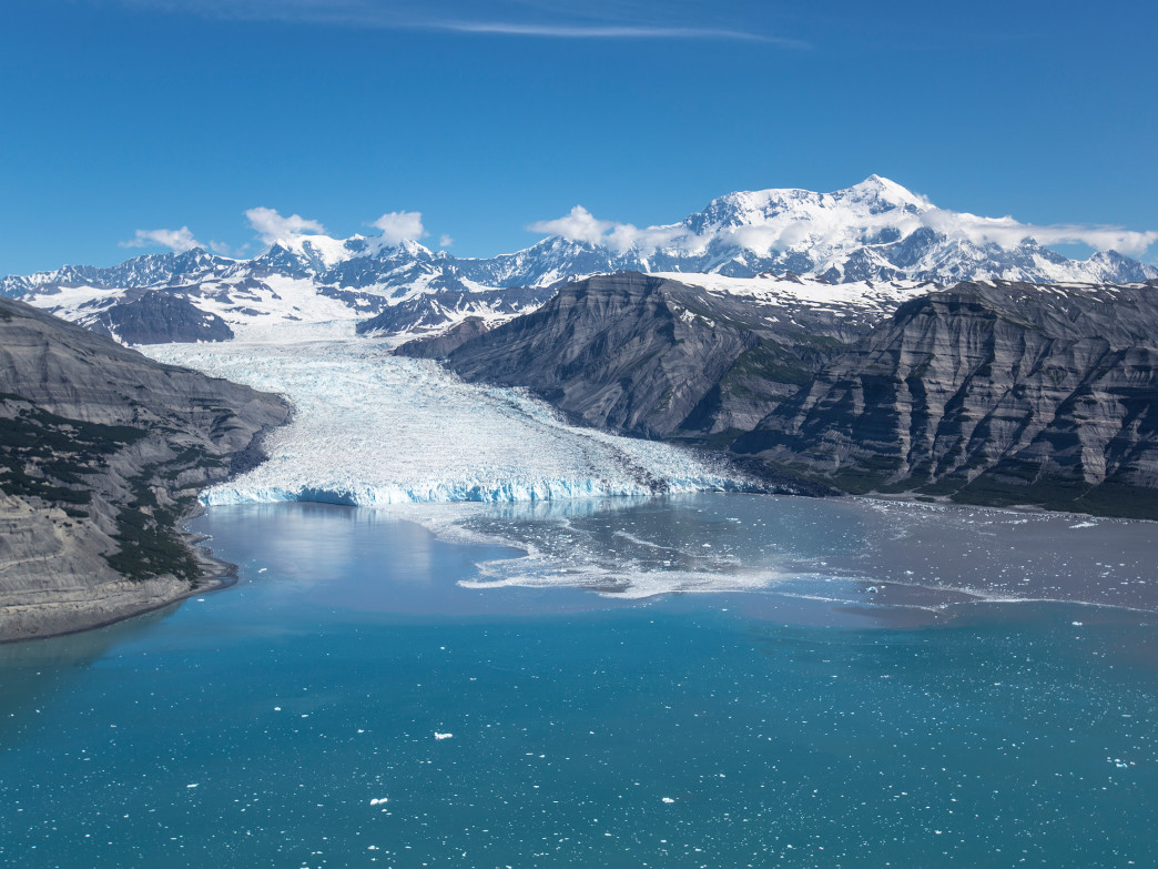
Traveling here requires a spirit of adventure and to get the most out of the state you need to enjoy venturing out on your own. We've prepared your Alaska Travel Guide, let's go?!
A little about Alaska
Binoculars are an absolute must, as is insect repellent; the mosquito is called the “Alaska state bird” and only industrial repellent keeps it away. Then there's the weather – although Alaska is far from the giant fridge that people imagine.
The state's southernmost city, Ketchikan, rich in native heritage, makes a beautiful introduction, while Sitka retains a Russian influence.
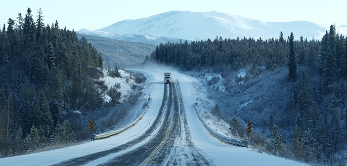
Further north are swanky Juneau, the capital; Haines, with its mix of veterans and newcomers; Skagway, reeking of the gold rush days; and Glacier Bay National Park, an expensive trip from Juneau that penetrates one of Alaska's most impressive regions.
To the west, Anchorage is the state's main population and transportation hub, while to the south are the stunning Kenai Peninsula and Prince William Sound.
The interior and north of Alaska are the “great land” par excellence – an undulating plateau divided by the Alaska Ranges and Brooks studded with glaciers, crisscrossed by rivers and with views of towering peaks, above all Mount McKinley, the highest in the country – tiny Talkeetna offers great views.
The mountain is at the heart of Denali National Park, while to the east is the unbridled vastness of the Wrangell-St Elias National Park.
Fairbanks, Alaska's second deviant city, serves as the center of the North, with roads that spread to hot Springs and five hundred miles north to the Arctic Ocean at Prudhoe Bay.
Chilkoot Trail
the most walk famous from alaska, the CHILKOOT TRAIL of 53 kilometers, it is a huge wild museum following in the footsteps of the original Klondike miners.
Starting in Dyea, 14 kilometers from Skagway, and ending in Bennett, Canada, the trail climbs through the rainforest into tundra filled with haunting memories of the past, including ancient boilers that once ran aerial trams and several crumbling cabins.
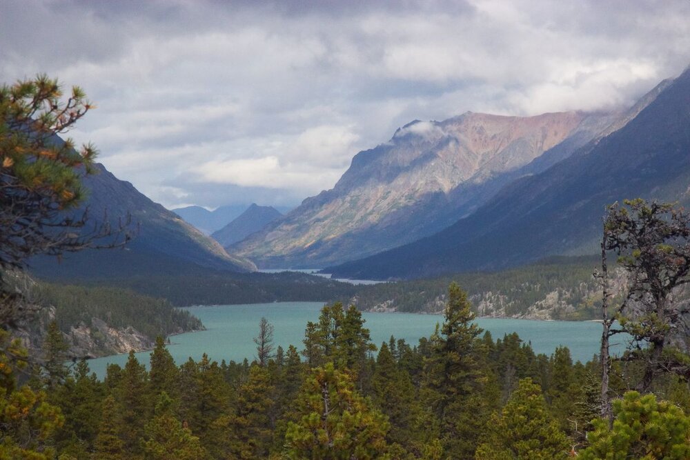
The three to five day hike is strenuous, especially the climb from Sheep Camp (1000 feet) to Chilkoot Pass (3550 feet).
You should bring food, fuel and a tent and be prepared for bad weather.
Dalton Highway
Built in the 1970s to serve the trans-Alaska oil pipeline, the mostly gravel Dalton Highway, or Haul Road, runs from Fairbanks 800 kilometers to the Prudhoe Bay oil facility on Alaska's north coast, about 500 miles away. 500 kilometers beyond the Arctic Circle.
It's a long, bumpy and demanding trip, so have good tires, a full tank of gas, provisions and, ideally, a beefy 4WD: most regular rentals are not allowed here.
Not far from Fairbanks, you begin to parallel the pipeline, winding up hills and in and out of the ground. At 188 miles, a sign announces that you have just crossed the Arctic Circle.
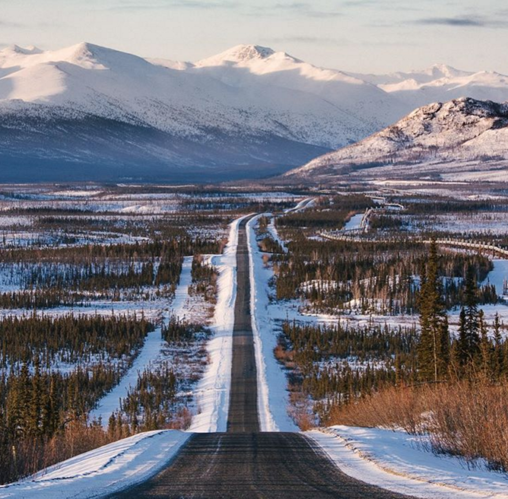
The road connects north through increasingly arid territory, finally dispensing with trees as you ascend through the desert of the Brooks Range, a 9,000-foot chain mostly within the Gates of the Arctic National Park.
From Atigun Pass, you descend through two hundred miles of great glacial valleys and shattered arctic plains to the end of the road at Deadhorse.
You can't walk the waterfront or camp here, so your choices are limited to staying at one of the US$ 190 hotels per night and taking a US$ 39 tour of the adjacent – and off-limits – Prudhoe Bay oil facilities for snorkeling. a toe (or your entire body) in the Arctic Ocean.
fairbanks
FAIRBANKS, 580 kms north of Anchorage and at the end of Canada's Alaska Highway, is a little bland, but a great base for exploring an interior of gold mines, hot springs and boundless wilderness, and for journeys along from the Dalton Highway to the Arctic Ocean Oil Field of Prudhoe Bay.
Fairbanks suffers notable extremes of weather, with winter temperatures dropping to -56°C and summer highs reaching 32°C.
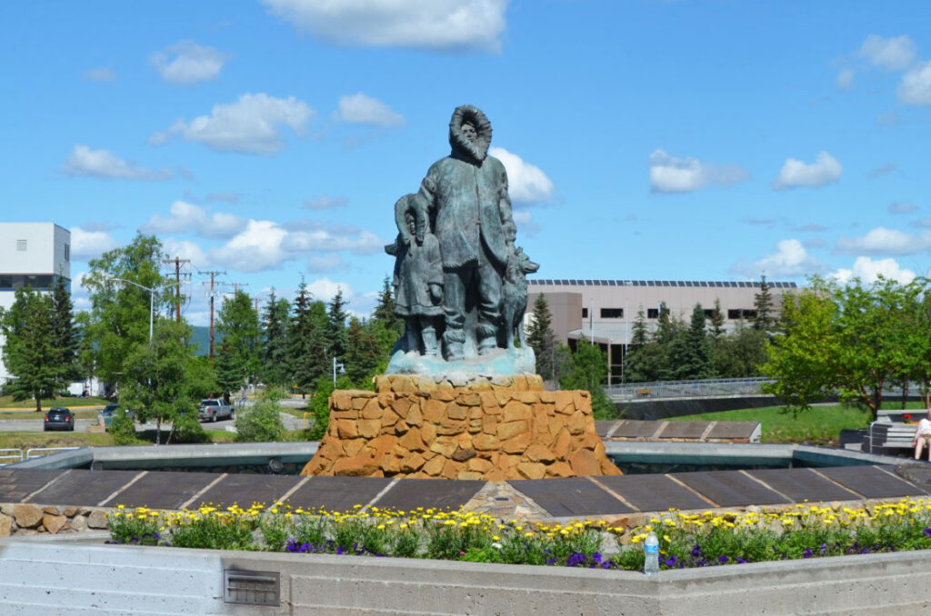
The proximity to the Arctic Circle means more than 21 hours of sunlight in midsummer, when midnight baseball games take place in natural light, and bar evacuees at 2am are confronted by the bright sun.
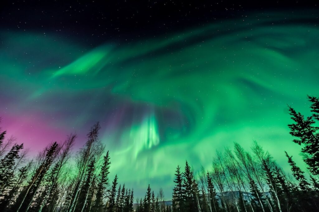
This is where the incredible aurora borealis takes place.
Brief history about Fairbanks
Alaska's second-largest city was founded accidentally in 1901 when a steamship carrying merchant ET Barnette ran aground in the shallows of the Chena River, a tributary of the Yukon.
Unable to move his supplies further, he settled in the desert, tending to the few hunters and prospectors in the area.
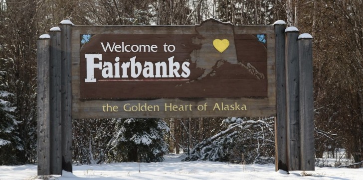
The following year, gold was found, a tent city sprang up, and Barnette made a mint.
In 1908, at the height of the race, Fairbanks had a population of 18,500, but by 1920 it had dwindled to just 1,100. 1970, when it became the center of construction of the trans-Alaska pipeline.
Festivals and Events in Fairbanks
the spectacular aurora borealis is a major winter attraction, as is the Ice Alaska Festival in mid-March, with its ice sculpture competition and dog sled races on the frozen downtown streets.
Summer visitors should try to watch the three-day Eskimo-Indian World Olympics in mid-July, when competitors from across the state compete in dance, art, and sports competitions, as well as some unusual ones like pulling the ears, knuckle hop, high kick and blanket toss.
Northern Lights - Northern Lights
The Northern Lights, or "Northern Lights”, an ethereal display of light in the upper atmosphere, gives its brightest and most colorful displays in the sky above Fairbanks.
For up to a hundred winter nights, the sky seems to glow with dancing curtains of colors that range from luminescent greens to fantastical veils that span the entire spectrum.
Named after the Roman goddess of dawn, the aurora is caused by an interaction between the Earth's magnetic field and the solar wind, an invisible stream of charged electrons and protons continuously blown from the sun into space.
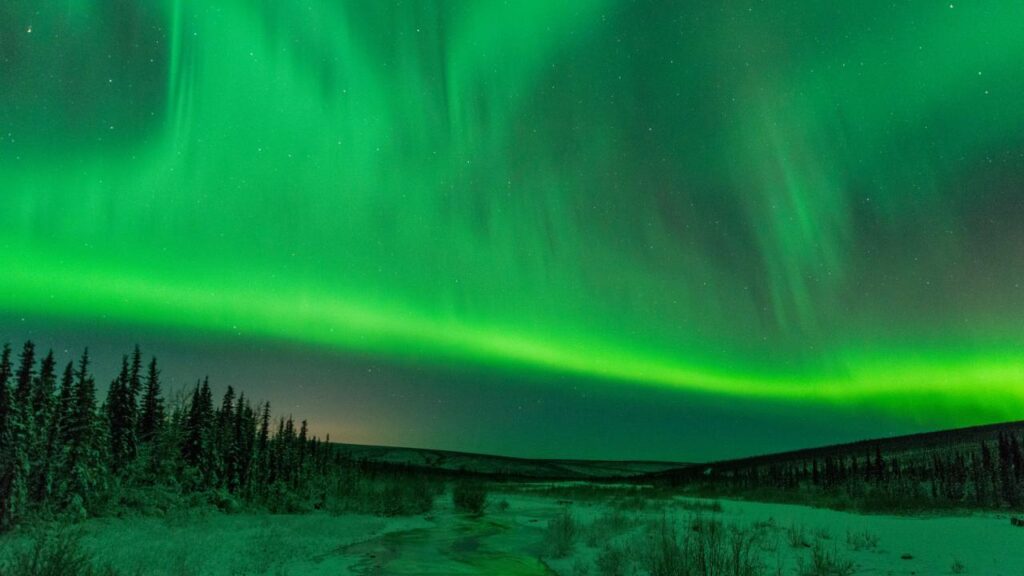
The earth deflects the solar wind like a rock in a stream, with the energy released at the magnetic poles – much like a neon sign.
The northern lights are more dazzling than december to march, when the nights are longer and the sky is darker, but late September can be good for summer visitors.
They are visible pretty much everywhere, but the further north the better, especially around Fairbanks.
Haines
Tiny HAINES sits on a peninsula at the northern end of the longest and deepest fjord in the US, Lynn Canal.
Somewhat overshadowed by its bolder neighbour, Skagway, it remains a slice of the real Alaska with an interesting mix of locals and urban runaways.
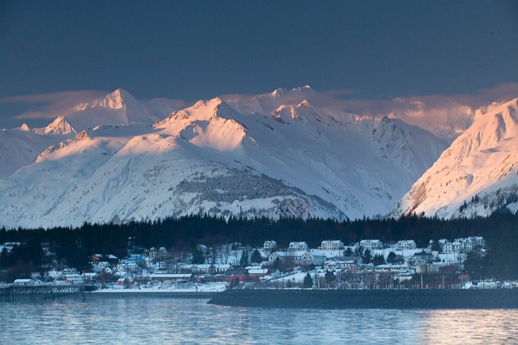
The Tlingit fished and traded here for years before 1881, when the first missionaries arrived. Today, the town survives on fishing and tourism, hosting in mid-August the Southeast Alaska Fairgrounds, crafts and log scrolling.
Kenai Peninsula
South of Anchorage, the Seward Highway hugs the coast of the Turnagain Arm, passing through Girdwood and Alyeska Ski Resort.
Just beyond, a side road passes the ever-popular Portage Glacier and a tunnel to Whittier, little more than a ferry dock that gives access to Prince William Sound.
Beyond Portage, the Seward Highway enters the Kenai Peninsula, “Anchorage's playground”, which at over nine thousand square miles is larger than some states.
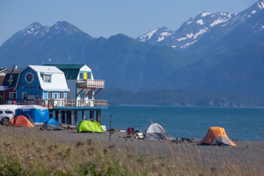
Offers an infinite diversity of activities and scenarios, based in communities like Seward, the base for awe-inspiring cruises Kenai Fjords National Park and the artistic Homer, where the waters and shores of glorious Kachemak Bay State Park are the premier destination.
Most Alaskans come to the peninsula to fish: the Kenai, Russian and Kasilof rivers host “fight fishing,” thousands of fishermen standing side by side using strength and knowledge to catch king salmon weighing over 30 pounds.
Camps along the rivers fill up quickly, especially in July and August.
Ketchikan
KETCHIKAN, nearly 1,100 kilometers north of Seattle, is the first port of call for cruise ships and ferries and its historic downtown, wedged between water and wooded mountains, is saturated in the summer.
Aside from the souvenir shops, it's charming, built on steep hills and partially supported on wooden stilts, dotted with boardwalks, wooden stairs, and totem poles.
In 1886, the city's numerous canning factories made it the "salmon capital of the world”, while forests of cedar, hemlock and spruce fed their sawmills. Ketchikan now looks to tourism as its savior, with neighbor Misty Fiords National Monument as the main attraction.
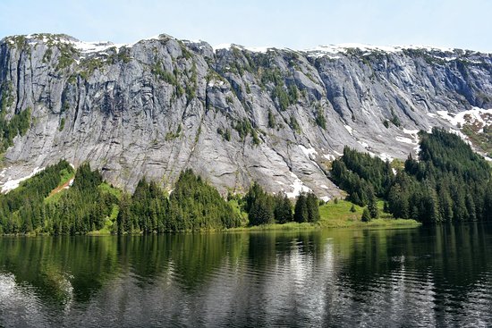
The fourth largest city in the state is a strong candidate for the wettest in the country; the average annual rainfall is 165 inches, but the perennial drizzle and sporadic rains don't spoil your visit.
Alaska cost and climate
Alaska is more expensive than most other states and major cities.
There is little economic accommodation and eating and drinking costs at least twenty percent more than in the lowest 48 (perhaps fifty percent in more remote regions).
Still, getting to know Alaska on a low budget is possible, although it requires planning and off-peak travel.
from june to august the prices of the rooms are exaggerated;
May and September, when rates are relaxed and the weather just a little cooler, are equally good times to go;
april or october you'll have the place to yourself, albeit with a smaller variety of places to stay and eat.
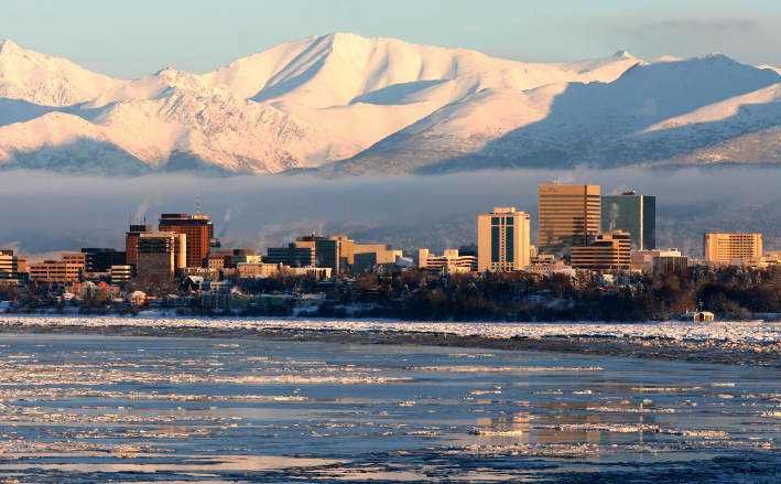
Winter, that's when hotels lower their prices by half 🙂
While winter temperatures of -40˚C are common in Fairbanks, the most touristy areas – the Southeast and the Kenai Peninsula – enjoy a maritime climate (7–18˚C in summer) similar to the Pacific Northwest, the which means a lot more rain (in some cities over 180 inches a year) than snow.
Notably, the summer temperature in the Interior usually reaches 26˚C.
Ground transport, despite the long distances, is reasonable, with backpacker transport between the main centers, although it is often easier to combine car hire with flights.
Prince William Sound
Prince William Sound, a largely untouched desert of fjords and steep mountains, glaciers and rainforest, lies between the Kenai Peninsula to the west and the Chugach Mountains to the north and east.
Filled with marine mammals, the Sound has a relatively low-key tourist industry.
The only significant settlements, the spectacular Valdez at the end of the trans-Alaska pipeline, and Cordoba, a fishing community accessible only by sea or air, are the respective bases for visiting the Columbia and Childs glaciers.
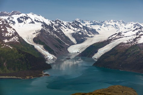
The peoples Chugach and Eyak they were moved by Russian poachers in search of sea otter skins and later by American miners and fishermen. The entire glorious show was nearly spoiled for good on Good Friday 1989 when the Exxon Valdez spilled eleven million gallons of crude oil.
Although 1,400 miles of coastline have been contaminated and around 250,000 birds have died, and the long-term effects are still unclear, today no surface pollution is visible.
skagway
SKAGWAY, the north terminus of the Southeast Ferry Route, emerged overnight in 1897 as a trading post serving the pioneers of the Klondike Gold Rush setting out on their five-hundred-kilometer ordeal.
Having grown from a cabin to a town of twenty thousand in three months, Skagway, riddled with disease and desperate violence, was considered the “Hell on earth??
It boasted over seventy bars and hundreds of hookers and was controlled by criminals, including Jefferson “Soapy” Smith, famous for deceiving hapless prospectors out of his gold.
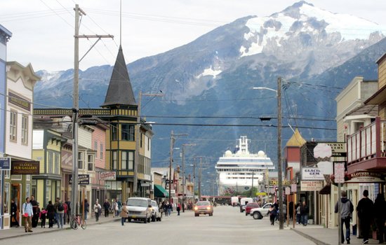
In 1899, the Gold Rush ended, but the completion in 1900 of the White Pass and Yukon Route railroad from Skagway to Whitehorse, the Yukon capital, ensured Skagway's survival.
Today, the city's 800 residents have gone to great lengths to maintain (or recreate) the original appearance of their home, much of which is in the Klondike Gold Rush National Historic Park, and in the summer up to five cruise ships a day call to appreciate the effort.
talkeetna
100 miles from Anchorage, the eclectic village of TALKEETNA has a palpable small-town Alaskan feel, but gets an international flavor from the mountaineers of the world, who come here to climb the Mount McKinley of 20,320 feet, generally referred to in Alaska by its Athabascan name Denali, "the big??
Whatever name you choose, North America's tallest peak rises from lowlands at 2,000 feet, making it the tallest in the world from base to peak (other major peaks, like Everest, rise from high).
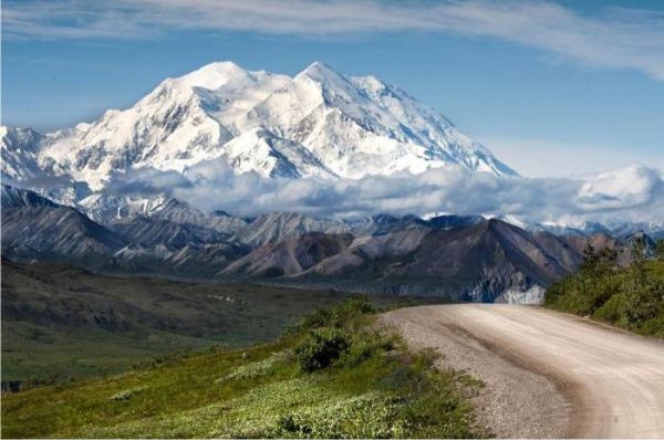
The mountain is best seen from the southern viewpoint of Talkeetna, which reveals the peak's transcendent white glow, in sharp contrast to the warm colors around it.
From mid-April to mid-July, climbers flock to Talkeetna to fly up the mountain: only half of the 1,200 who attempt the climb each year make it, usually due to the extreme weather.
Wrangell-St Elias National Park
As Denali gets more crowded, people are increasingly traveling to the WRANGELL-ST ELIAS NATIONAL PARK, in the southeastern tip of the Interior, where four of the continent's great mountain ranges – Wrangell, St Elias, Chugach and Alaska – press together.
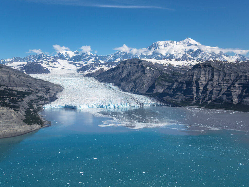
It's all written on a grand scale: glacier after massive glacier, gorge after vertiginous gorge, and nine of the sixteen highest peaks in the US, all entwined by twisting rivers and idyllic lakes where mountain goats, Dall sheep, bears, elk and caribou roam.
Alaska travel guide
Did you like the tips?!
Read too:
10 best places to visit in March in the USA
